
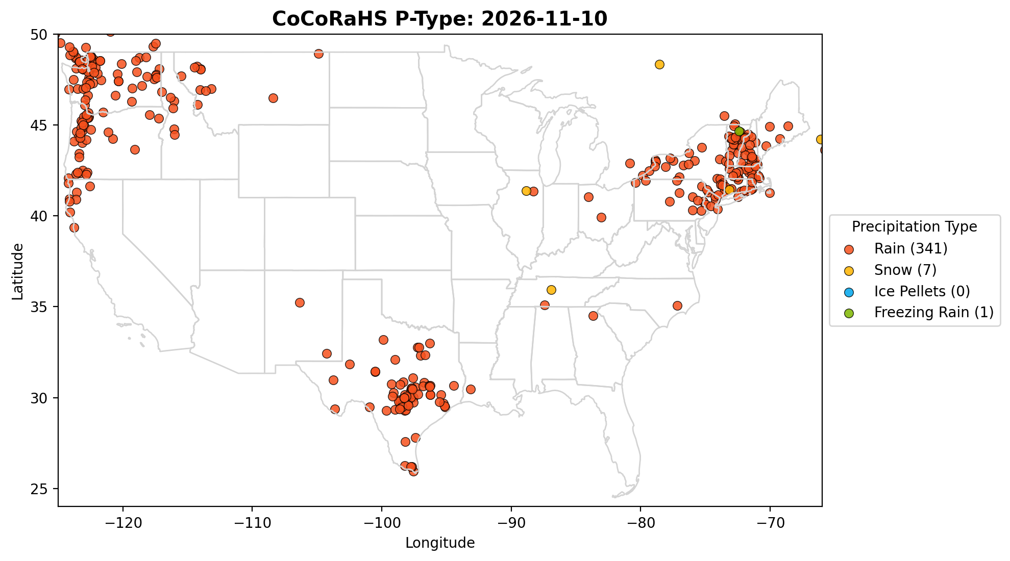
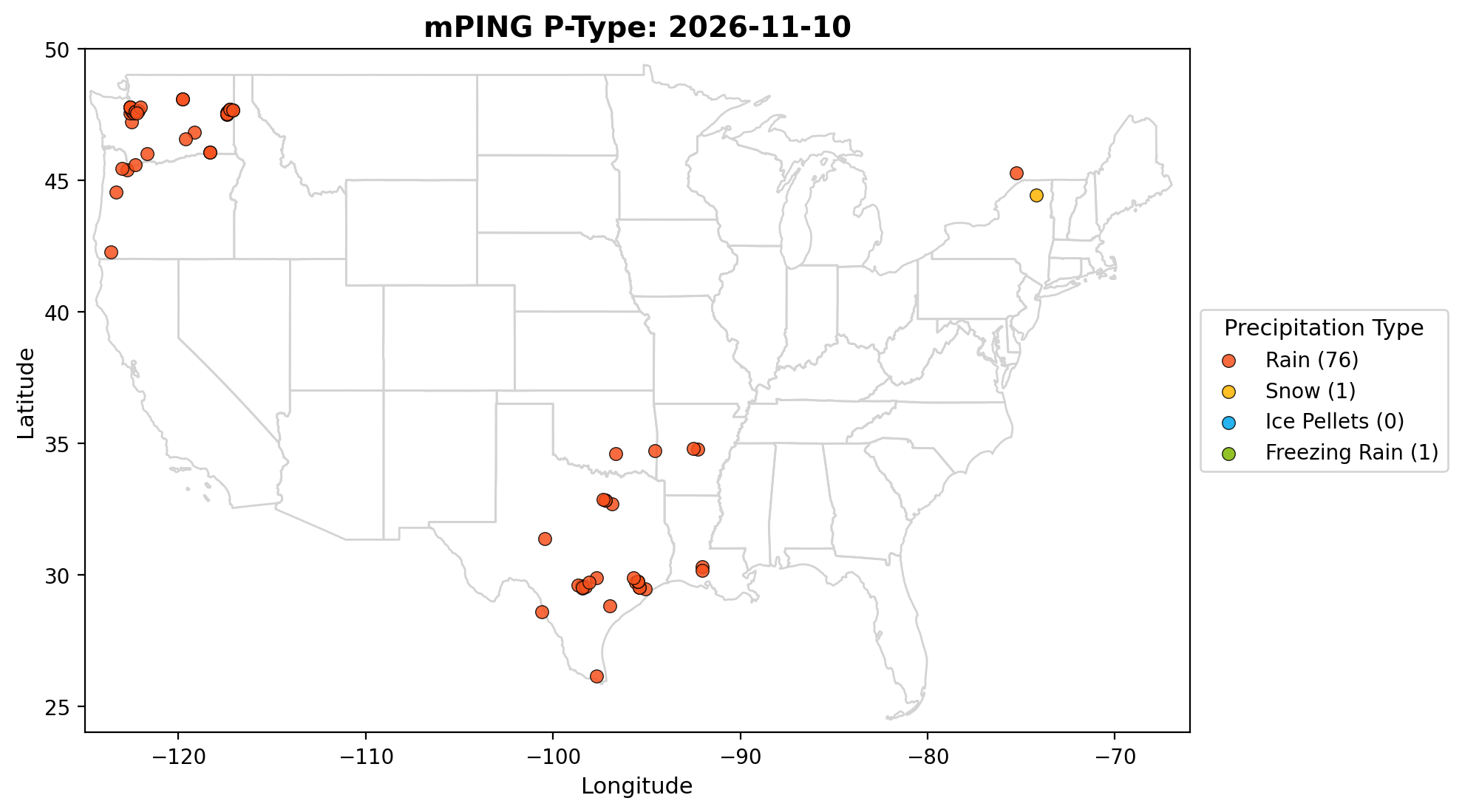
Every day, volunteers across the country report rainfall, hail, and snowfall through the
CoCoRaHS network. Using these community observations, we automatically generate
an up-to-date precipitation map and dataset helping visualize where and which type of
precipitation occurred, updated twice daily at 11:00 AM and 11:00 PM CST.
Daily CoCoRaHS Map
ANN Precipitation Type Probability Forecast
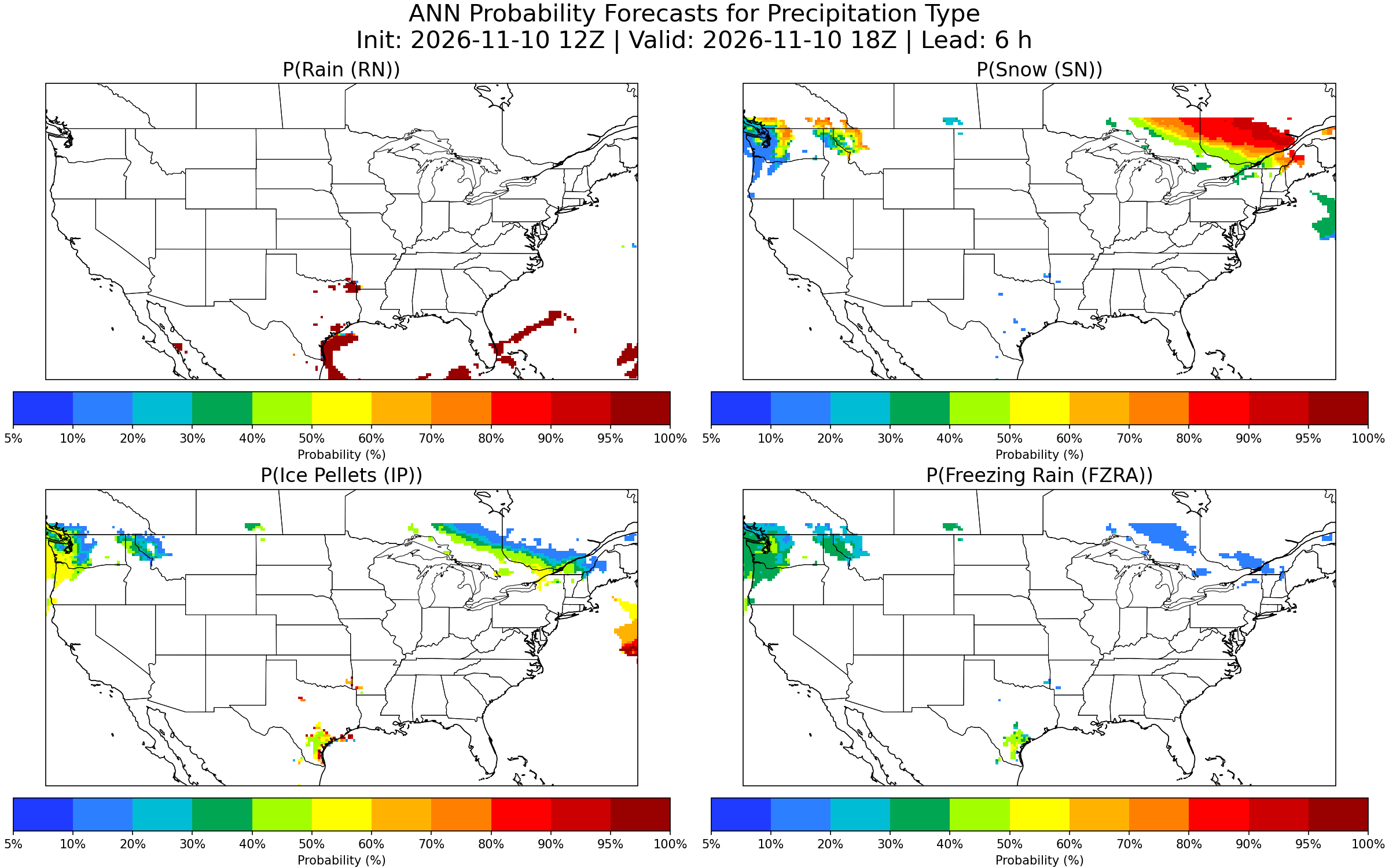
Using GFS model data and an Artificial Neural Network (ANN), we generate automated
precipitation type probability forecasts across the contiguous United States.
Probabilities for Rain, Snow, Ice Pellets, and Freezing Rain from +6 h to +120 h, updated daily.
Initialized: November 10, 2026 12:00 UTC
·
Valid through: 2026-11-15 13Z
·
GFS 12Z cycle
Click image to open full size